
Hiking in Costa Rica means watching the landscape change as you move through different elevations. Each altitude brings its own climate, creating pockets where specific plants and animals have made their homes. The southern Pacific region shows this off well, with trails running from beach level up into the high mountain passes.
The microclimates here shape how you hike. Early starts help with coastal heat, while mountain trails need planning around afternoon clouds. Weather patterns change fast with elevation – you might need sunscreen and a rain jacket in the same backpack. Wildlife adapts to these changes too, with different birds and animals active at each level.
These elevation shifts mean you’ll see something different on every hike. Beach trails have their morning monkey troops and macaw flocks. Mid-elevation paths wind through dense forest where oaks and wild avocados grow. The highest trails break through the treeline into open air where winds sweep across mountain peaks. Each trail tells its own story about how Costa Rica’s mountains meet the sea.
I use these versatile trail runners on my hikes in Costa Rica. The aggressive grip tackles steep terrain while maintaining comfort for long days on mountain paths.
El Miro: Jaco’s Hidden Viewpoint Trail
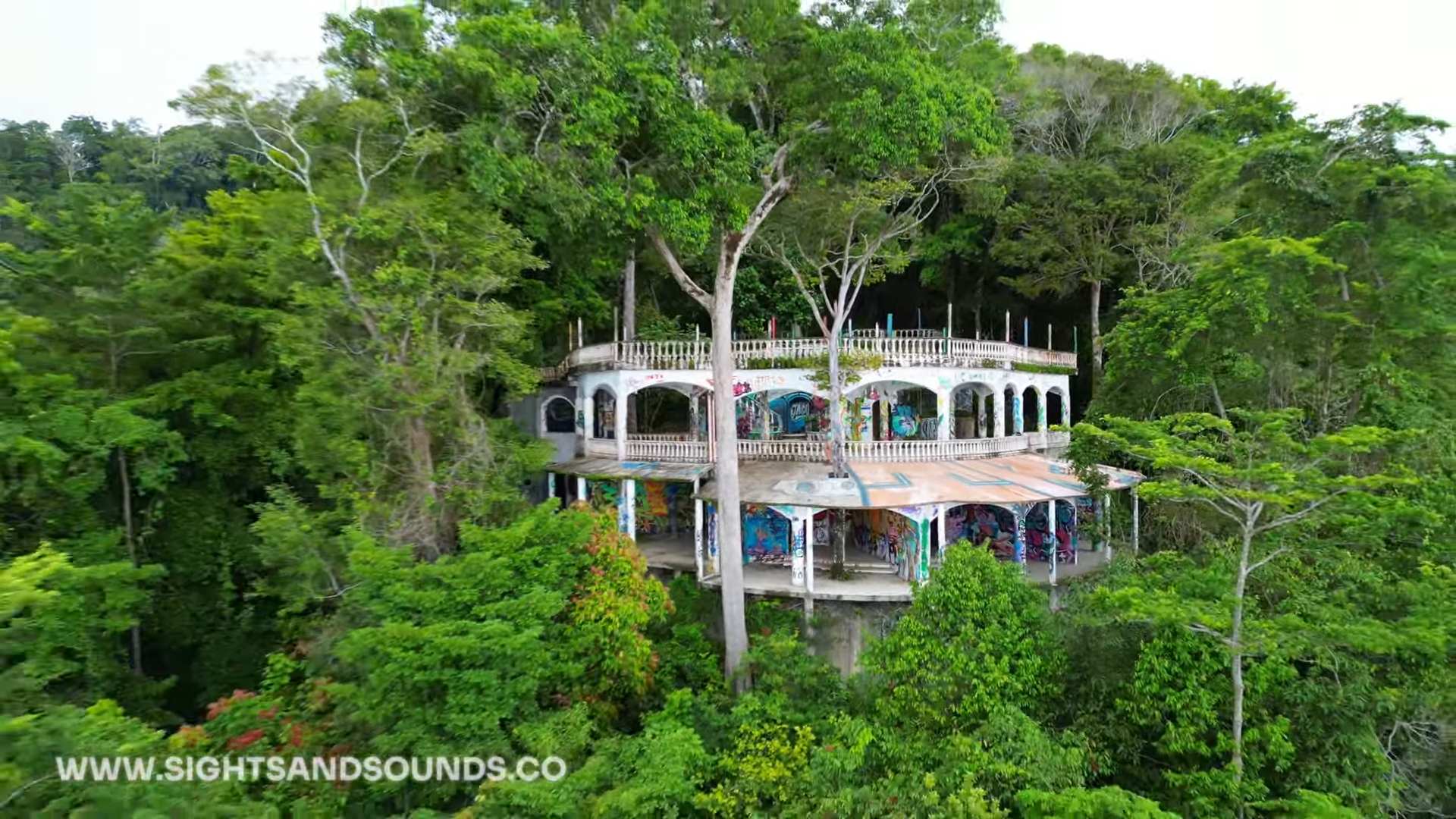
The El Miro trail starts at the south end of Jaco beach, climbing steeply through forest to a dramatic clifftop viewpoint. From here, the entire curve of Jaco Bay stretches north, while the coastline south towards Playa Hermosa disappears into the distance. The morning light shows surfers catching waves below, while late afternoon brings spectacular sunsets.
Getting to the trailhead takes just minutes from central Jaco. Park near the south beach access, where a marked path leads into the trees. The climb takes 30-45 minutes, with some rope-assisted sections on the steeper parts. Early morning or late afternoon hikes avoid the midday heat.

This short but rewarding hike offers a completely different perspective on Jaco. While most visitors stick to the beach, this elevated viewpoint reveals how the mountains meet the Pacific. Macaws often fly past at eye level, and the breeze at the top provides relief from the beach heat below.
Pack a water bottle, good walking shoes and your phone. A small backpack helps. Hike with others when you can and tell someone your plans. Watch your footing on the steep sections, and if you go for sunset, head back down before dark.
El Ascensión: Cloud Forest Peak Trail

The trail starts near the Pan-American Highway’s highest point, where clouds regularly sweep across the continental divide. This high-altitude hike offers rare access to Costa Rica’s páramo ecosystem, where stunted trees and unique vegetation adapt to life at 3,300 meters (11,000 feet).
Hidden behind a small restaurant at the mountain pass, this trail climbs through cloud forest before emerging into open páramo landscape. The stark transition from dense forest to alpine-like conditions shows how elevation shapes Costa Rica’s diverse environments.

The summit trail reveals both Caribbean and Pacific slopes on clear mornings, though clouds often roll in by mid-day. This ecosystem hosts unique highland species like the volcano junco and timberline wren, found nowhere else in Costa Rica.
Watch for altitude symptoms. Start slow and drink water. Check the weather before you set out and turn back if it changes. There’s cell service at the trailhead, so tell someone your plans.
Los Gigantes: Valley View Trail

High in the mountains above San Isidro del General, the Los Gigantes trail network winds through working coffee farms into pristine forest. The trails offer sweeping views across the Perez Zeledon valley, where on clear days you can see all the way to the Pacific Ocean.
Most mornings in Costa Rica start with coffee for me, and 1820 coffee was my daily cup. It’s well priced and delicious. Try it before your vacation, or bring the taste home after.
These paths started as coffee farm access routes but have evolved into maintained hiking trails. As you climb, the landscape shifts from sun-drenched coffee plants to cool forest shade. The elevation gain reveals how the valley’s patchwork of farms gives way to forest-covered peaks.

Multiple viewpoints along the way showcase the region’s agricultural heritage. Morning fog often fills the valley below before burning off to reveal the expanse of San Isidro and the surrounding mountains. Local farmers still use parts of these trails, making this a unique mix of working land and natural space.
Bring water, sun protection, a light jacket, snacks and some cash for the local stores. There are few places to refill, so carry enough water. Stay on the marked trails, since they cross private farms, and watch for afternoon rain.
Subscribe For More
These three hikes show different sides of Costa Rica’s southern Pacific region, each offering unique views and experiences. From beach town overlooks to high mountain passes, and agricultural valleys, the diversity of landscapes here creates endless hiking possibilities.
Remember that conditions change throughout the year, so checking recent trail reports helps with planning. Each of these hikes works well as a half-day adventure, leaving time to explore the surrounding areas.
Subscribe to the YouTube channel for more Costa Rica hiking videos, trail updates, and hidden spots across the southern Pacific region.